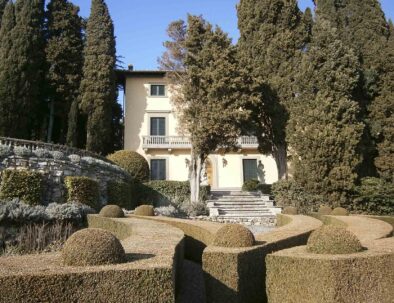
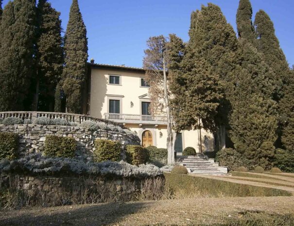
Ortaglia

Itinerary 4

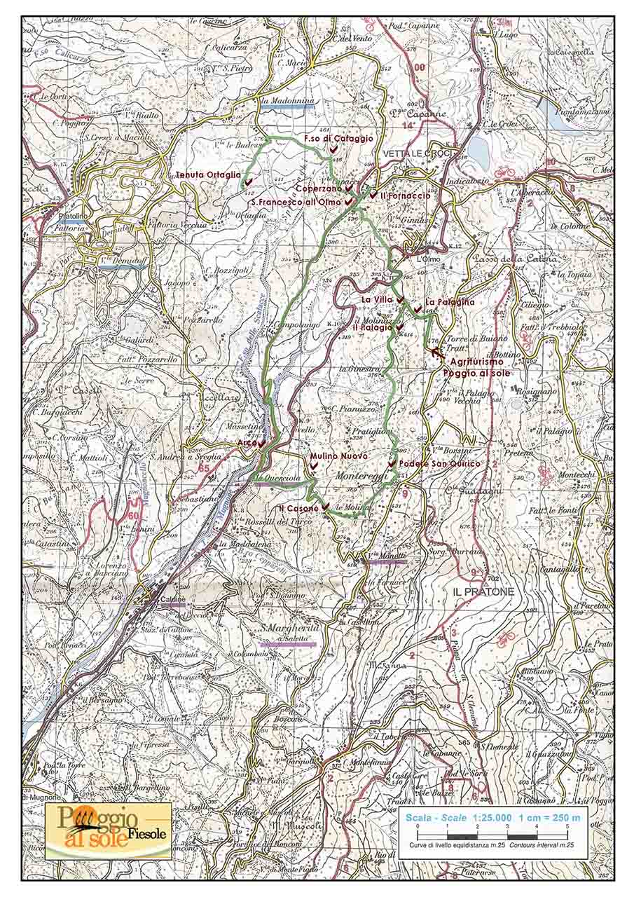
"Like was a painting" Poggio al Sole - Tenuta Villa Ortaglia (- Querciola) - Poggio al Sole

The view from Agriturismo Poggio al Sole is a stunning one. When you get there for the first time, you feel the need to stop for a minute to enjoy the sublime panorama. The eye lose itself in the infinite details of this magic pattern: bell towers, houses and farms, towers, monasteries, farmhouses, country roads, the lines and gracious geometry of the fields, the olive tree groves, the rows of cypresses, the woods and vineyards, and above all this, the thin air which separates us from an ever-changing horizon. There must be some real magic here, as it is so beautiful that watching it is simply not enough: we wish we could plunge in it, touch it, and have wings to fly over it and embrace it all. But we are not the only ones who long to make this encounter, it’s the landscape self that is drawing us toward it, to capture the moment and see our recklessness and curiosity fulfilled. Because this land was created by the hard work of men over the course of time, and here is where it belongs: like two living things that could not exist without each other. Right in front of the Agriturismo Poggio al Sole, on the opposite side of Mugnone Valley: this is exactly where the harmonious synthesis took place, among the vineyards of Tenuta Villa Ortaglia (the main goal of our itinerary), on the borders with the Park of Villa Demidoff. The park was originally built by Francesco I de’ Medici between 1569 and 1581 as the summer residency for his beloved Bianca Cappello, in a location of rare beauty, just like the entire valley overlooking the fairy-like landscape of Fiesole hills and the Dome of Florence cathedral.

Distance:
1° option: Poggio al Sole – Tenuta Villa Ortaglia – Poggio al Sole: 8 km
2° option: Poggio al Sole – Tenuta Villa Ortaglia – Querciola – Poggio al Sole: 12 km
Elevation grade:
1° option: 390 m
2° option: 560 m
Difficulty:
1° option: easy
2° option: easy to average
(be careful when fording streams during rainy periods)
Estimated time:
1° option: 3 hours
2° option: 5 hours
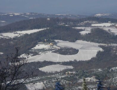
Suggested time of the year: all year round (there may be muddy segments during rainy days).
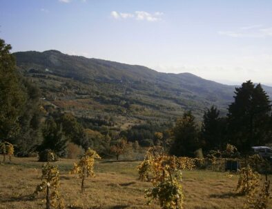
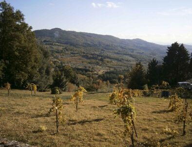
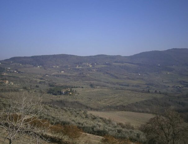
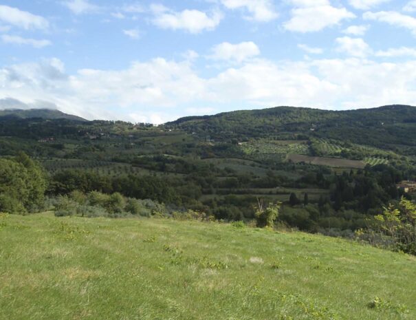
Interest: landscape-history.
Webpages to know more:
http://www.bml.firenze.sbn.it/it/caldine.htm
http://www.cultura.toscana.it/architetture/giardini/firenze/parco_villa_demidoff.shtml
http://www.ortaglia.com/

The first segment of the footpath is similar to Itinerary 3, which you find below.

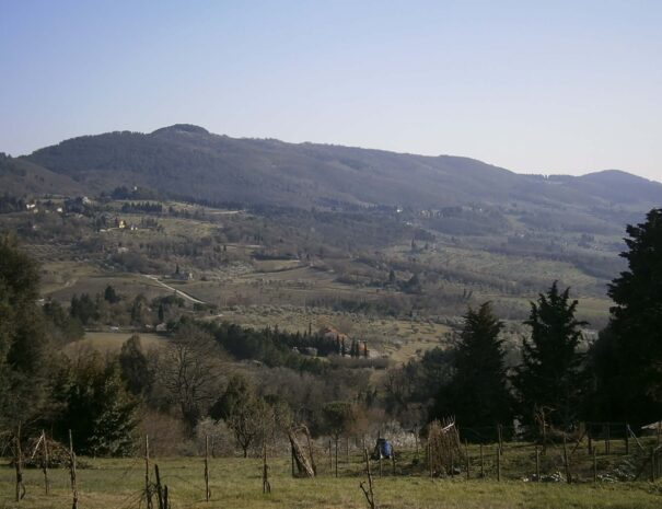
As we leave Agriturismo Poggio al Sole we get to a crossroad where a rural road stands: Via Torre di Buiano. Turn left on the descending road; pass by the dilapidated rural complex La Palagina until you reach a large plain, with a hay barn and the farmhouse La Villa. A spring and a tank can be found in proximity, where one can hear water gurgling after abundant rainfalls.

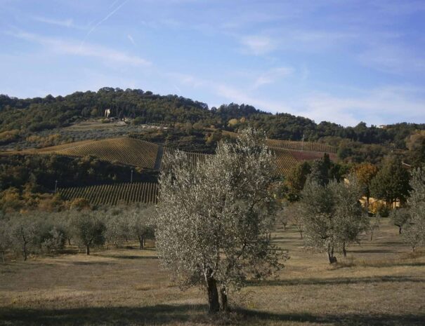
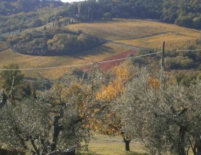
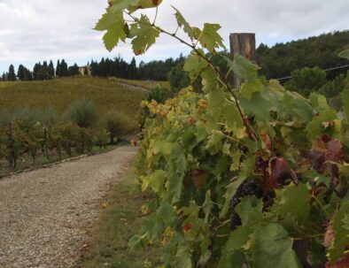
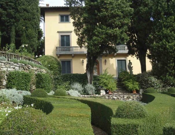
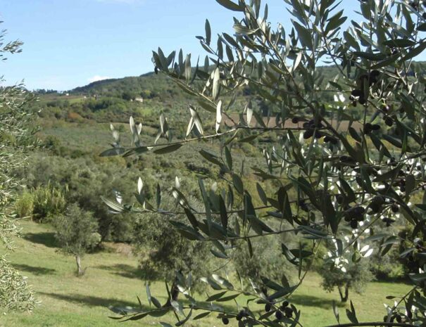
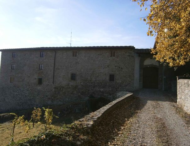
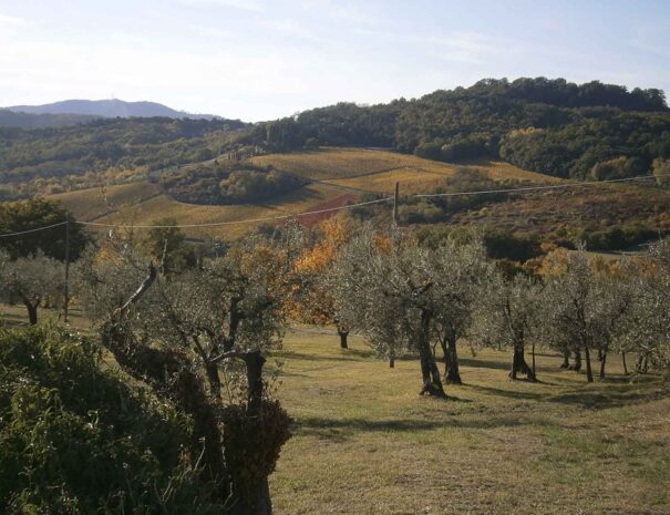
Now, instead of turning left as in itinerary n.3, go straight down the road surrounded by vineyards: on your right stands the village Olmo with Villa Ginnasi tower, and a little further up Villa Capacci, formerly known as Fattoria dell’Olmo (our first destination of the trail).

Cross over Fosso dei Bosconi and take the uphill road on the right, Via Faentina, and after two bends- approximately 300 mt (mind the vehicles!)- take the little road on the left, via del Canto ai Rosai, another place named after the local vegetation. The road is bordered by Scots pines and olive trees. Pass by a modern pink building on your left, from where you can catch a glimpse of the hills of Fiesole and Florence- then Fosso del Carpine, marking the border between the municipalities of Fiesole and Vaglia. Finally, with nut trees on the sides and an old watering place with spring, you will proceed to the first crossroad on the right, toward a group of typical rural houses. Once you get there, follow the wall covered with rosemary, a typical Mediterranean plant and one of the main herbs used in Italian cooking. The Latin name “ros marinus” (sea dew) reminds us that this plant mainly grows by the sea. By the next crossroad, opposite the entrance of Villa La Torricella, leave the chapel of San Francesco all’Olmo behind and take the uphill road Via di Campilungo. After passing a Holm oak, ignore the red and white sign of trail n. 65 (which suggests turning left), and go ahead for a few meters, then turn right.
Browse among the old buildings. Today they are finely restored, but their name (“the Oven”) clearly states what was the original purpose of this group of houses, built in proximity of the farmhouse Olmo. Towering above your head, the farmhouse can be easily reached through a short uphill road which leads to a fantastic viewpoint over Tuscany hills. The large complex that you have just reached is a medieval building belonging to the Hospital of Santa Maria Nuova in Firenze. Both the functional purpose of this important religious and hospital institution, and its structure (with the subsequent addition of two lateral wings) have significantly changed over the course of time, as the complex was converted into a farm. Situated in the middle of a large estate, the farm has been active since the early years of the 20th century, and in the late 18th century it already included 26 smallholdings.
Back at the junction with trail n.65, you will reach a small group of buildings in the little neighbour of Coperzano. On the first of these buildings, named Torricella (small tower), the lower part of a medieval tower is still visible. A few meters on, and in proximity of a gate, proceed on the untarred road until you get to a metallic fence and some poles which delimit a recent cow herd. Walk aside this fence following the white and red sign of the trail, leaving the view of the Mugnone Valley behind you, with the typical fields of mixed cultivations, the hills of Fiesole, Mount Fanna, Poggio Pratone and Guadagni hill.
A little downhill and then, just after crossing the channel of Cafaggio, the road starts climbing again, among brambles and roses, and you will reach a bended pine, a sign of the strong winds that often sweep through these lands (in fact, we are close to a farm called “The house of wind”). Here, the characteristic landscape of Fiesole seems now far away). The farmhouse Villa le Badesse towers over this territory, showing the typical appearance of a métayer’s house, provided with all the necessary tools of rural life: hay barn, stable, dovecot and manure. From the farmyard (the typical paved courtyard where farmers used to process their products), the view opens up again over the Mugnone valley, while the vegetation down the valley is marked by the reappearance of olive trees. Ignore the rural road which seems to disappear in the dark green and silver-gray colour of the olive tree leaves, and take the other unpaved road which runs along olive tree plantations. Proceed downhill for about 200 mt; turn left at the first crossroad, and then right at the second crossroad, into a rugged trail made up of brambles e shrubs, which will lead you straight to the backyard of Villa l’Ortaglia.
Now lose yourself among the vineyards, lulled by the gentle ups and downs of this path that takes you from the vines to the hills on the opposite face of the mountain, toward Montereggi (the starting point of this itinerary). Here you will recognize the Agriturismo Poggio al Sole, with its characteristic yellow colour (the yellow of Florence) surrounded by olive trees and cypresses. You will notice from a distance the orderly alignment of smallholdings, the alternation of fields (cereals, forage etc.), tree and shrub plantations (vines, olive trees, fruit trees), the woody areas and remote farmhouses, the real “workshops” of this territory, assigning and regulating the everyday work of farmers. You will breathe and taste the flavour of the sky. As the Florentine writer Bruno Cicognani wrote: “space and horizon will look like a cradle, able to contain that desperate thirst for wild freedom, which only the beauty of these places can calm down”.
Leave the Villa and take the road back to the chapel of San Silvestro all’Olmo, where you can choose between variant 1 (back to your residence) and variant 2 (going to Via di Campilungo). If you choose option 2, be aware that the trail is mostly downhill for about 2.5 km, with the exception of a short plain section in the middle. The path will rejoin with the trail n. 14 coming down from Montesenario. The olive trees and vineyards of Villa Ortaglia will make you company, while on the opposite side (called Bosconi) the landscape is characterised by farm houses and other buildings. Among these buildings stands the 15th century Convento della Maddalena, built on a design by Michelozzo. Approaching the convent on foot gives you the opportunity to appreciate the amazing games of perspective created by the large three arched porch. This territory abounds with reference points, and you will see more and more coming, in a continuous change of lights, places and colours. After leaving Villa di Campilungo the downhill roads becomes steeper, and after a few bends you will cross the channel Fosso del Carpine. A few meters further down the valley, at the confluence of the two channels Fosso del Carpine and Fosso delle Scalacce, lies the spring of river Mugnone.
After a plain section, the road intersects with the ancient via Faentina (while the new road, built in 1913, runs alongside on your left). Quickly you will reach Arco (embedded in the wall on the left you will find a public fountain with drinkable water). Here once stood a little hospital with the oratory of Santa Maria della Neve, which is now a private building, but the façade by Andrea del Buono is still visible. An official act promulgated in 1381 claimed that the place “was meant for civil use and for the poor people”. It offered 4 bed places: 2 for women and 2 for men. Until the half of the 19th century the building also included an orphanage for infants abandoned by their parents (mostly illegitimate children whose parents were in really miserable conditions).
Once you have reached the new Via Faentina, proceed downhill for a few meters until Querciola (from the Latin word quercula, meaning “small oak”). Take the road Via Vecchia delle Molina on the opposite side, a very narrow lane surrounded by building which departs from the Restaurant Mario (marked as trail n.9). Be careful, as some sections of the stone pavement have collapsed. As one can tell from the name of the road and the homonymous channel, several mills were active in this area: one was situated inside the above mentioned restaurant, another one in the building corresponding to house number 8, and a third one could be found in the lovely complex in Via di Rimolle. From the intersection with Via di Rimolle, cross the little bridge and then proceed uphill among the hills, illuminated by the sunlight. The mountains toward north protect this side of the valley from the cold winds, and the midday sunlight exposure ensures pleasant conditions. This is why this place is full of houses, purposely built with orientation favoring midday sunlight. Leaving the view of Fiesole hills behind you, begin your return path toward the Agriturismo. Pay attention to the land terracing and the accurate construction of aqueducts: these structures were needed to regulate the flow of water and to optimize the performance of work in the fields. Once you have reached a triple intersection, take the central road Via delle Molina which intersects with Itinerary 3, to be taken in reverse direction.
Before doing this, it is worthwhile to make a little deviation and go up the two bends leading to the rural villa “Il Casone”, a Renaissance building in Medici style with a sober architectonic geometry. On the left side a channel can be noticed, which supplied the mills. The water coming from this and other streams in the surrounding was channeled into the aqueduct built by the Medici family in the XVII century to supply Palazzo Pitti (the family residency in Florence). The aqueduct is still visible downstream. Proceed along the channel through an ancient path paved with sandstone.
Walk through the buildings immersed in a magic surreal atmosphere, where the traces of remote past are carefully preserved. Then, as the light hardly makes its way through Holm oaks and thick holly fronds, the road starts climbing, leading to shadowy mysterious ravines. Other buildings silently welcome the visitor, as suspended in an indefinable past. Mixed feelings of hesitation and curiosity move the visitor. Here, one can sense the breath of ancient things, and smell the moisture coming from the foliage. The absence of noise and the silent scenery seem to suggest a sudden, mysterious abandon of this area, a little too fast for the liveliness which once characterised this magic corner of the world. In fact, from at least the XV century to the XIX century, five to nine mills were active in this place, some of which have been converted into civil buildings. Today they are still recognizable by their elevated structure. Most of these mills were converted to civil use, though maintaining the original three-storey structure (a basement for wheels and gears, the ground floor for grinders and a processing area, and the upper floor for residential use. The abundant springs of the Caves of Montereggi supplied the water which powered the large stone disks used to crush the wheat. These mills represented the productive centre of the community, a gathering place and a work place at the same time, where the tight bond between the city and the countryside provided an essential contribution to the subsistence of the respective populations. The road continues steep uphill, along a robust dry stone wall made from white blocks of local stone, all the way to the little graveyard of Montereggi. The rugged terrain reminds us how hard it must have been for wagons to pass on these roads. After the graveyard stands the little parish of Sant’Ilario, which origins date from the IX century. Take a minute to turn your back and admire the large and bright landscape appearing from a distance, with the hills of Fiesole and Mount Rinaldi in the background, protecting the access to the Mugnone river and Florence basin.
When the road rejoins with Itinerary 1, leave trail n. 9 and take the downhill road Via di Montereggi on your left, delimited by a wooden fence (on your left stands the house of S. Quirico holding). The road soon becomes untarred but always of easy access. This area was the most suitable for cultivations, in fact you will plunge into a landscape of vineyards, olive groves, fruit trees, oak woods and rural houses, a splendid countryside where nothing is casual, but the result of the secular metayage tradition, a system based on sharecropping between a landowner and a tenant. This tradition was largely used until the second half of the past century. Watch attentively the vineyards: some are intertwined with other trees, usually maples or populus. This is not a sign of degrade or abandon, on the contrary: these trees are real wrecks, a sort of art work, both natural and artificial, which was once mastered by the farmers, who found the way to turn the harshness of rural life into a prosperous activity.

Be careful when you walk this road, since there are no signs: by the first crossroads, in proximity of the vineyards of the Farmhouse Borsini (who once owned 11 lands in this area), ignore the climbing road and turn left, then, by a second crossroads in proximity of a cypress tree, turn right, leaving the main road and driving along a fence on the left.
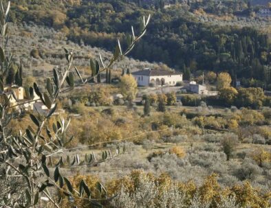
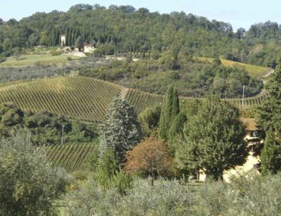
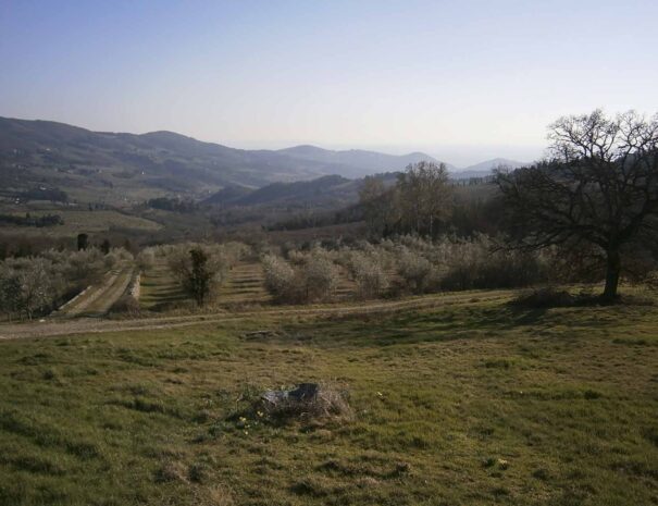
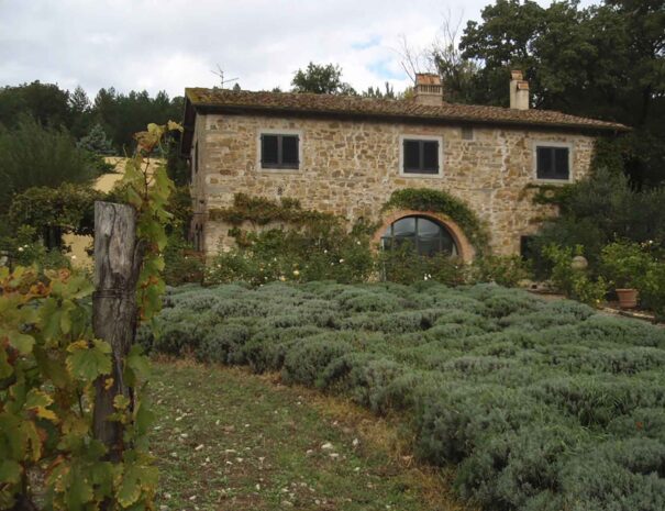
Cross the channel Fosso di Buiano; then take again the direction on the left. Two splendid rural structures will come in sight, both of which display the typical dovecot in the middle of the roof. By the following crossroads turn right passing by the B&B Palagio, then walking through olive groves and vineyards, the barn hay and the farmhouse La Villa and following the uphill road (which you are now doing in reverse direction), you will find yourself back at Agriturismo Poggio al Sole, from where your excursion started.


Itinerary and photos by Giovanni Crescioli:: www.FiesoleBike.it